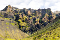
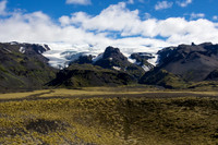
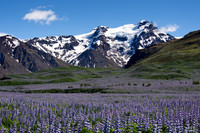
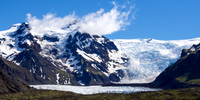
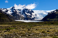
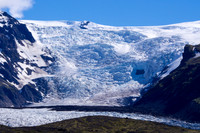
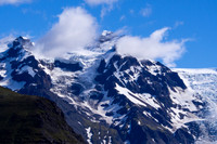
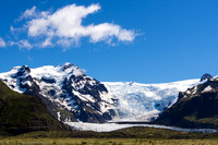
Our time in the South of Iceland was focused primarily on Skaftafell National Park, which includes a spectacular collection of peaks and glaciers, with impressive waterfalls, refreshing birch woods, and flowing tongues of sediment-covered blue-white ice reaching out from the Vatnajokull glacier. A web of braided rivers, resulting from the retreating glaciers, thread their way across the vast plains of silt and sediment flowing toward the Atlantic ocean. This outwash plain, or sandur, is the largest in the world, covering an area of 1300 square kilometers. Skaftafell is Europe’s largest National Park, composed of natural forest and rock-strewn slopes spread between glacial tongues. With Europe’s largest glacier (Vatnajokull) and Iceland’s highest peak (Hvannadalshnúkur, 2110m), it is a unique and inspiring place to visit.
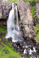
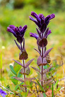
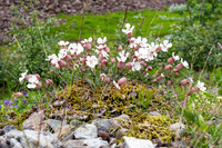
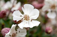
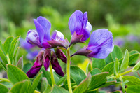
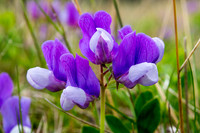
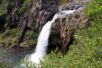
During our time in Skaftafell, we hiked several of the trails that start from the Visitor’s Centre. On our first hike, which started under threatening skies that soon turned into a slashing downpour, we walked past a small but beautiful waterfall on our way to Sjonarsker viewpoint, which offered expansive views across the Morsardalur valley and into the Skeidararjokull glacier. Then we made our way through twisted birch woods to the Morsa river, which we crossed and followed a path across the valley, walking over the rocks and sediment left behind by the retreat of Morsarjokull tounge of Vatnajokull. Our destination was the birch forest below Mt. Baejarstadarskogur. In the Baejarstada forest, birch trees grow higher than in any other place in Iceland, along with bluebell flowers, yellow saxifrage and purple lupins.
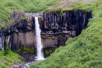
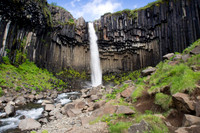
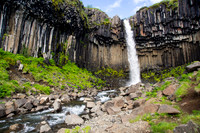
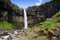
On a gorgeous, clear day, we had an unforgettable hike that took us around the Skaftafell peninsula. We started with a short walk to the spectacular Svartifoss, (Black Falls). This famous waterfall flows over a cliff that is bordered on both sides by tall black hexagonal basalt columns, resembling pipes of a giant organ. We continued across the mountain heath to the viewpoint at Sjonarnipa, where you can sit at the edge of the western cliffs overlooking the Skaftafellsjokull glacier and across to Iceland’s highest peak, Hvannadalshnjukur, reaching 2,118 meters (6,950 ft). The glacier and peak provided an inspiring backdrop for our walk along the western cliffs of the glacier to the scree-covered peak of Kristinatindar, which is located between the Skaftafellsjökull and Morsárjökull glaciers, with excellent view of each and on a good day views on to the ice cap Vatnajökull, along with surrounding mountains. Its slopes are gorged and steeped by thousands of years of moving ice, but although it is a challenging climb, it not an overly difficult climb for fit hikers, at least in dry conditions. Unfortunately, the clouds had moved in and we decided not to attempt the ascent to the peak. So we were content to rest for a while at the saddle, just below the steep, scree trail to the top. On the return loop, we made a short detour to a grassy crest from which we had a marvelous view over the Morsarjolull and its glacier lagoon, and into the Kjos valley. We made a stop at a small tarn that reflected the clouds of sunset, and we sat at Sjonarnipa viewpoint to watch the midnight light on the peaks of Hvannadalshnjukur. It was long, tiring, but energizing and inspiring hike.
While visiting Skaftafell National Park, we stayed in Hof, a small village about twenty kilometers south of the park. There was a small church nearby, the last turf church built in the original Icelandic style, and one of six churches still standing, all of which are preserved as historical monuments.
Leaving Skaftafell, we visited the peaceful village of Vík, which sits under the shadow of Myrdalsjokull glacier and the ominous Katla glacier-volcano, which is one of Iceland’s most active. We enjoyed a walk on the black beach that is next to the pinnacles of Reynisdrangar, which sit just offshore. According to legend, the pinnacles were left standing there after two trolls tried to pull a three-mast ship past the headland, but were caught by the first rays of sunshine and turned to stone.
Not far from Vik is Skógafoss, one of the largest waterfalls in Iceland, with a width of 25 metres and dropping over 60 meters from the clifftop. Walking close to the waterfall, you are enveloped in a cloud of spray and sound that closes you out from the world around. A climb 370 steps to the top of Skogafoss waterfall provides a wonderful view out over southern Iceland’s coastline. According to legend, a Viking named Thrasi hid his hoarded gold under the falls. While at Skogar, we visited the regional folk museum, which has a wonderful collection of artifacts and mementos of the region’s past, housed in nicely preserved old turf-roofed houses.
Just off the ring road is Seljalandsfoss, an outstanding waterfall that drops 60 metres over a large cliff in the Eyjafjöll Mountains. Here you can walk behind the waterfall capture unusual images from the other side, although the spray quickly soaks both your clothing and the camera lens.
Like all the regions of Iceland, the South requires many more days to adequately explore even a few of the special places that fill the area. Left for another trip was the famous forested valley of Thorsmork and the very popular four-day hike between there and Landmannalaugar, encircled by multi-colored mountains and a large high temperature geothermal area. Next time!
Category:Scenic
Subcategory:Landscapes
Subcategory Detail:
Keywords:Iceland, nature
© Sustaining Images, All Rights Reserved