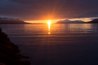
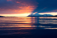
Our visit to the north started in Akureyi, the second-largest town in Iceland (population 17,000). We arrived late in the day after a long drive from Snefellsness, but it was just in time to watch a magnificent midnight sunset from the harbor. During the remainder of our time in the north of Iceland we stayed in Husavik, a small seaside town that sits on the eastern shore of Skjálfandi bay, known primarily for its successful whale watching tours.
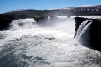
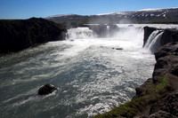
Our first stop outside Akureyi was at Goðafoss, which is among Iceland’s larger waterfalls and also one of the more beautiful. The name translates as “waterfall of the gods,” and it is associated with one of the most important events in the history of Iceland. According to the legend, a local chieftain, Thorgeir, who in his role as lawspeaker in Iceland was faced with the task of settling the growing disputes between Christians and those who worshipped the old Nordic gods. Although he was a heathen priest himself, he decided that the best way to bring peace was for all of Iceland to convert to Christianity. To symbolize the conversion, he threw all his Norse idols into the waterfall, thus giving Godafoss its name.
While in Husavik, we were treated to a perfectly clear sky one evening, which also happened to be the time of the full moon. We walked down to the sea’s edge to watch the setting sun reach its low point just above the northern horizon well after midnight, then slide slowly across the sea, starting its ascent a couple of hours later. During the “night”, the full moon barely rose above the horizon in the south, showing its full round shape for only three hours before dipping back down below the horizon. It was an incredible experience, a rare opportunity to experience sunset and sunrise almost simultaneously, while observing the full moon make its lowest and shortest transit in the night sky. Unforgettable.
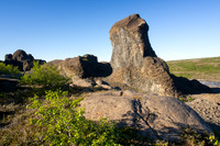
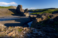
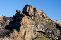
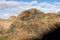
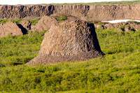
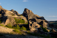
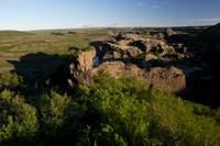
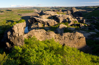
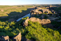
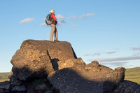
We made two visits to Jokulsargljufur, or the Jokulsa river canyon, which is part of the Vatnajokull National Park. Jokulsargljufur is one of the largest and most impressive of Iceland's river canyons, over 24 km long, up to ½ km wide, and in place 100 m deep. We hiked along the river on two different days in the area of Vesturdalu, where there are amazing rock formations, including the huge rock pillars Karl and Kerling (Old Man and Old Woman). These two were out one night at a party, and upon returning home the woman couldn’t get her husband to cross the river to their cave, and the sunrise caught them, instantly turning them to stone.
Our short hike in Asbrygi canyon took us through a forest of birch, willow, and fur trees, with high canyon walls on both sides. In the centre of Ásbyrgi canyon is Eyjan, a platform-like island, and at one end of the canyon is Botnstjörn pond. According to legend, the canyon Asbyrgi was made when the Norse god Odin's eight-legged horse put one of his hooves down on earth. Adding to the aura, the tall vertical stone faces of the canyon and Eyjan are rumored to be the capital city of the hidden folk. Indeed, it is easy to imagine hundreds of eyes peering at you as you walk through the trees.
We also visited Dettifoss, Europe’s most powerful waterfall, and its sister Selfoss, a smaller waterfall just upstream. Dettifoss is 44m tall and 100m wide and has a flow of up to 500 cubic meters per second. You could really feel its power as it roared over the high drop to the canyon bottom below. Fed by the sediment-rich meltwaters of the Vatnajokull glacier far to the south, the water has a sense milky color. It’s a very popular spot, but we walked about 1 km downstream and found both nice views and peace from the tour buses.
We also visited Lake Myvatan, Iceland’s fourth largest natural lake. It is a breeding area for more species of ducks than anywhere in the world. The Myvatan basin sits on top of the mid-Atlantic ridge, and this has produced an amazing landscape. The area around the lake is an otherworldly setting for mudpots, impressive lava formations, lunar-like volcanic craters, and newborn lava fields (from recent eruptions). Just offshore sits Mt. Hverfell, a beautifully formed 2500 years old tephra crater that is about 1 km in diameter and 140 meters deep. It is one of the largest round cinder craters of its kind in the world.
At Myvatan we walked at: Skutustadir Craters, an easy stroll through a set of pseudo-craters, with plenty of diverse bird life by the lake; Dimmuborgir, short hiking routes through dozens of interesting lava formations suggesting various mythological or other-worldly creatures; Mt Hverfell, the beautifully formed tephra crater (described above); Namaskaro, a barren, red expanse of geothermal activity at the foothills of a beautiful volcanic mountain, full of bubbling pools of sulfuric mud cutting through terrain that is rich with colorful minerals and is continuously steaming, omitting the pungent order of sulphur.
We finished off our visit at the Myvatn Nature Baths, northern Iceland’s version of the famous Blue Lagoon. It’s smaller than its big brother to the south, but it’s also much less crowded, and it provides a perfect place to soak in powder-blue, mineral-rich waters. An excellent end to a full day of walking.
Category:Scenic
Subcategory:Landscapes
Subcategory Detail:
Keywords:Iceland, nature
© Sustaining Images, All Rights Reserved