For several years, I’ve wanted to hike the Tonto Loop Trail at the Grand Canyon. I’m calling it a “loop” although technically it is a “U” that is separated by several miles between trailheads. This means you have to either leave a car near one trailhead and take a bus over to the other to start the hike, or you have to arrive back at the rim in time to take the bus back to your car. So it takes a bit of planning, but the infrastructure is in place to make it possible.
To take this hike, you first descend either Bright Angel Trail or the Kaibab Trail about three-quarters of the way to the river and then take the trail across the Tonto Plateau that sits about 1500 ft above the Colorado river, before ascending back to the rim. Descending either trail, you drop about 3500 ft below the rim, and you will have to climb an equivalent amount back up to the rim on the latter part of your hike. This means that in total, you will have approximately 7500 ft of elevation change (including some rolling elevation change on the Tonto Trail). This is equivalent to approximately 700 floors. To put this in perspective, it’s like walking down and up the Empire State Building (102 floors) nearly three and one-half times. In terms of mileage, the hike is approximately 13.5 miles total (5+ miles on the Bright Angel, 4.6 miles across on the Tonto Trail, and 4+ miles on the Kaibab). It requires more than a casual level of fitness, and it should only be attempted in cooler weather, but there is almost no chance of getting lost, and the trail is well maintained all the way. Of course, the Bright Angel and the Kaibab trails are heavily used, and you will have plenty of company on the way up and down, but along the Tonto you are likely to be completely alone as you cross the Tonto platform. Water is (usually) available on the Bright Angel trail, but not on either the Kaibab or Tonto. Even in cooler weather, you will consume at least a gallon of water on this strenuous hike.
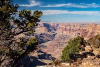
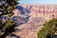
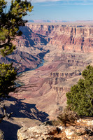
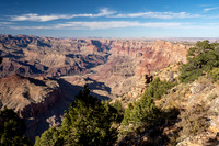
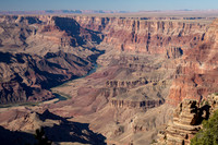
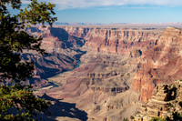
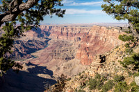
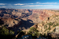
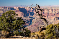
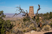
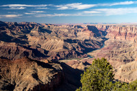
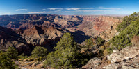
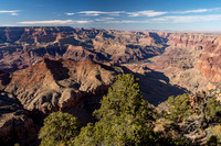
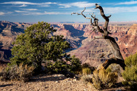
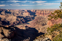
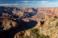
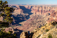
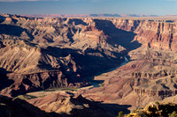
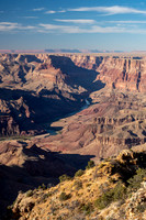
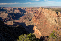
I had tried several times to go on the Tonto Loop hike, but each time something happened that required postponing it. I was finally able to take my long-delayed hike over our Fall semester break (2019). We booked a night at the Bright Angel Lodge, located just next to the trailhead. We entered the park through the east gate, stopping at Desert View a little after 3:00 PM. From here, there is a very nice view of the Colorado river as it snakes through the canyon that it carved over past six million years. The lands of the Navajo Nation lie to the west, stretching across northeastern Arizona toward Lake Powell, and North Rim of the Grand Canyon is to the north. The confluence of the Little Colorado River and the Colorado River is visible , and on a clear day it seems almost within reach. Desert View is a great place to get a sense of the grandeur and scale of both the canyon and the surrounding area. On the day we arrived, a strong west/northwest wind had been blowing for the previous 2 days as a cool front moved through, and this had cleaned out most of the usual haze (from the heat rising up from the lower elevations), smoke (from forest fires), and pollution (coming from as far away as Los Angeles, but also coming from local sources, such as the coal-fired power plant at Page and the thousands of cars driving and idling along the rim) that often obscure views in the canyon.
We were very fortunate to see the canyon with almost none of the usual sources of obstruction. This exceptionally clear afternoon provided marvelous views to the west and north, and the multi-hued and multi-layered colors were stupendous. We walked around Desert View area (plus the nearby Navajo Point) for well over 2 hours. The colors and shadows were gradually changing, providing a slow-motion view of the canyon drawing the shades for the night.
Most hikers taking the Tonto Loop go down the Kaibab and up the Bright Angel, because ascending the Kaibab Trail is a steep, brutal hike, with unrelenting steps and switchbacks. But I wanted to be on the Kaibab Trail in the late afternoon light, when the amazing panoramic views of many of the iconic buttes and promontories in the Grand Canyon are at their best. What I neglected to take into consideration is that my ascent would not only be much steeper than on the Bright Angel, but I would be starting my hike up the trail after already hiking nearly 10 miles. So I was really dragging while climbing (yes, a more accurate description than walking) up the Kaibab. Well, never mind, I made it, and I was right about the nice afternoon light. The views were stunning, and colors in the various layers of limestone and basalt were at their peak in the last 2 hours of the day. And to top it off, the full moon was rising at the end of my hike. It took me more than 10 hours to complete the loop, and I nearly depleted my emergency energy reservoir at the end of the day, but every step was worth it!
Although I started early, my hike was delayed a bit, because after I had started down the Bright Angel Trail, I learned that the water pump at Indian Gardens campground was not working that day, and water would not be available. I had only filled a couple of bottles, plenty to get me to Indian Gardens but not nearly enough to get me around the loop. So I had to go back up the trail and fill all my bottles. My pack was heavy, but I felt assured that I would have enough water for the day. The trail was mostly in the shadow of the canyon until I reached the outskirts of Indian Gardens, so I was quite comfortable as I descended, making what was for me record time. I reached the intersection with the Tonto Trail (5 miles) after about 2.5 hours, having my first lunch course in the shade of a cottonwood tree, listening to the sound of the water running down the creek that provided water to a line of Cottonwood trees that ran along the banks.
The trek across the Tonto plateau was pleasant and very quiet. I only encountered 1 individual hiker and 2 couples, all of whom were surprised to see me, since they were all coming from the “correct” direction and hadn’t seen anyone else on the trail. It was the hot part of the day, and shade was almost nonexistent, but the views were excellent. I traversed around the mouth of 3 canyons, taking a couple of rest breaks before making my way up the hill to reach the Kaibab trail at Tipoff Point. Just before reaching the Tipoff, I had a nice view of Phantom Ranch and Bright Angel Creek that flows down from the north rim.
Heading up the Kaibab, I was already tired, and it wasn’t long after the Tipoff that I encountered a series of steep switchbacks and seemingly endless steps that eventually took me along a wall that offered very nice views south and east. At Skeleton Point (3 miles from the rim), there was a shelf that offered views back to the west, looking down on the Tonto Plateau. I was able to see the trail I had taken across the platform, looking back almost to where I started across at Indian Gardens. After Skeleton Point, another climb (but not as steep or as long) took me to Cedar Ridge, leaving me only a little over a half mile before I reached Ooh Aahh point, where Bliss was waiting for me, and from where it was less than a mile to the rim. As I walked from Skeleton Point, the afternoon light was gently bathing the buttes and cliffs of the canyon, and the shadows were getting deeper. It was like being in the middle of a painting, and even though I was nearly too tired to walk, I was awed by the slowly changing colors and shapes. Even after sunset, the afterglow of the evening sky lit the canyon walls. Arriving at the rim completely exhausted, and just in time to take the last bus of the day, my mind was saturated with deeply embedded images of colorful shapes and formations that had taken millions of years for nature to paint.
Throughout my hike, the clarity of the air and sky, which brought out the wonderful colors of the rock formations, drew my attention to the panorama of the landscape. My camera lens stayed in the wide-angle mode instead of focusing on the individual formations and the smaller details. This means that most of the photos in this gallery are expansive, giving you the breathtaking views but not the subtle particulars. The Grand Canyon has its name for a reason I suppose! You will also find multiple photos of the same scene, shown in different light as the sun dropped in the afternoon sky and as the shadows framed and highlighted certain areas and brought out the layers and gave emphasis to the ways in which water, wind, and time have carved out an amazing sculpture. I hope to take this hike again, in the other direction, and perhaps I’ll have time to capture a few more individual details along the way.
Thank you for coming along with me on this strenuous but rewarding hike deep into one of the world’s truly inspiring wonders. I hope you will enjoy my attempt to share with you some of the images that were in front of me during my trek through this grandest of canyons.
Category:Scenic
Subcategory:Landscapes
Subcategory Detail:
Keywords:
© Sustaining Images, All Rights Reserved